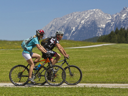
Round tour "Spechtensee-Runde"


- culturally interesting
- Flatly
Interactive elevation profile
Create PDF
Tour-Details
Paths covering:
A very pleasant and diversified tour from Bad Mitterndorf via Tauplitz to the Spechtensee, to Wörschach and back to the starting point vie Trautenfels .
Technique: ***
Quality of experience: ****
Recommended season:
- May
- June
- July
- August
- September
- October
Properties:
- Loop
- Cultural/historical value
Starting point of this tour is the municipial office in the center of Bad Mitterndorf. Beginning this tour you shall turn to the left in direction of the area called "Neuhofen". From then on you follow the signpostings of the tour "R19" passing the popular ski flying hill at the Kulm to the railway station in Tauplitz. Passing the railway station you carry on the route to Wörschachwald and to the small lake "Spechtensee".
After a downhill via a graveled road you reach the village called Wörschach. Passing the village you go straight ahead over a bridge and take the route "R7" along the river "Enns" to Trautenfels. From then on the route "R19" leads upwards all the way back to Bad Mitterndorf.
Directions:
Wir starten in Bad Mitterndorf vor dem Gemeindeamt und biegen im Ortsteil Neuhofen nach links ab. Jetzt folgen wir der Beschilderung >R19< vorbei an der Skiflugschanze Kulm zum Bahnhof Tauplitz. Vorbei am Bahnhof Tauplitz folgen wir den Wegweisern nach Wörschachwald und zum Spechtensee.
Nach einer Abfahrt über eine Schotterstraße erreichen wir den Ort Wörschach. Wir fahren durch die Ortschaft Wörschach, am Bahnhof vorbei, geradeaus über die Brücke der Enns. Von dort immer der Enns entlang, den Ennsradweg >R7< bis Trautenfels. Hier folgen wir bergauf wieder der Markierung >R19< bis Bad Mitterndorf.
Tip:
You will fall in love with the lake "Spechtensee" and its unique nature. In summer time you might jump in as it is a wonderful refreshment. At the terrace of the restaurant on the other hand you will enjoy delicious dishes.
Safety guidelines:
Please note the exclusion of liability!
Equipment:
The right bicycle: Touring bike or mountain bike
City bikes or racing cycles are not recommended due to graveled roads throughtout parts of the tour.
Break-downs might occur, most of the times far away from any service providing station. Therefore to the best advantage tools, implements and appropriate material are always good to have with you.
Additional information:
More information:
TVB Ausseerland - Salzkammergut
Tel. +43 (0)3622 / 54040-0
further information:
- Flatly
")
")
")
Getting there
Detailed information how to get to the Ausseerland – Salzkammergut you will find on our website!
Public Transit
ÖBB (train): www.oebb.at
Verbundlinie Steiermark (bus): www.busbahnbim.at
Transport service Narzissenjet:
www.ausseerland.at/narzissenjet
No transport of bicycles possible!
Parking
In the center of Bad Mitterndorf are not a lot possibilities for parking available. Therefore it is recommended to leave the car 150 m further at the Grimminghalle.
- Spring
- Summer
- Autumn
Please get in touch for more information.
Bad Mitterndorf 58
8983 Bad Mitterndorf
Phone +43 3623 2444
E-Mail info.badmitterndorf@ausseerland.at
Web www.ausseerland.at
Interactive elevation profile
Create PDF
Tour-Details
Paths covering:


