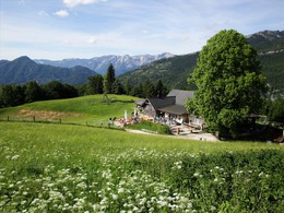
Jubilee Walk to Hoisnrad


- culinary interesting
- Flatly
Interactive elevation profile
Create PDF
Tour-Details
Starting place: 4820 Bad Ischl
Destination: 4820 Bad Ischl
duration: 3h 0m
length: 9,8 km
Altitude difference (uphill): 566m
Altitude difference (downhill): 573m
Lowest point: 482m
Highest point: 989m
difficulty: medium
condition: medium
panoramic view: Great panorama
Paths covering:
Hiking trail
powered by TOURDATA
Hike to a mountain which boasts a magnificent view of Bad Ischl This loop trail starts directly at a signpost. A narrow way leads along a wall to the right and widens after few metres with a left turn. Softly it is getting upward in southeast direction. We ignore a signpost with „Nach Bad Ischl Hubkogelsiedlung“ and go on straight ahead. At an other signpost „Zur Engelwand“ we have a nice view over Bad Ischl and we keep on the right. Shortly after a small building on the right side we come after 30-minutes to a signpost (013°38'45 “O - 47°41'52“ N - 660m). Here we could descend on the right to Perneck. Nevertheless, we follow the "jubilee way" for another 30 minutes upward up to the "Niederrad" (Alpine grassland on the right). Here is also a way on the right leading down to Perneck (013°39'37 “O - 47°41'41“ N - 836m). Short time later we reach a logging trail which we ignore. After another 15 minutes we have arrived on the Hoisenrad (013°39'42 “O - 47°41'29” N - 969m). For the descent we must climb up to the access road of the alp. At a signpost with three boards we go on left in the direction „Perneck (Salzberg)“. After 500 m we reach the signpost on the Gschwendtalm (013°39'58 “O - 47°41'15“ N - 990m). Now we leave the logging trail on the left down trough Alpine grasslands. Here one must care, the way, which not to lose the path. In the forest area we cross a logging trail twice until we reach the old forrest road ("Rettenbachleiten"). On this road we return straight ahead to the starting point.
Starting point: Small parking place in the Rosenkranzgasse (013°38’11“O - 47°42’24“N) bei Haus Nr. 44a
Destination: Small parking place in the Rosenkranzgasse (013°38’11“O - 47°42’24“N) bei Haus Nr. 44a
further information:
- culinary interesting
- Flatly
- Board possible
Most economical season
- Spring
- Summer
- Autumn
Please get in touch for more information.
4820 Bad Ischl
Phone +43 6132 27757
Fax machine +43 6132 27757 - 77
E-Mail office@badischl.at
Web www.badischl.at
http://www.badischl.at
Interactive elevation profile
Create PDF
Tour-Details
Starting place: 4820 Bad Ischl
Destination: 4820 Bad Ischl
duration: 3h 0m
length: 9,8 km
Altitude difference (uphill): 566m
Altitude difference (downhill): 573m
Lowest point: 482m
Highest point: 989m
difficulty: medium
condition: medium
panoramic view: Great panorama
Paths covering:
Hiking trail
powered by TOURDATA


