Snowshoetrail - Höhenloipe


- Suitable for families
- Flatly
Interactive elevation profile
Create PDF
Tour-Details
Path number: 3
Starting place: 4645 Grünau im Almtal
Destination: 4645 Grünau im Almtal
duration: 0h 30m
length: 1,5 km
Altitude difference (uphill): 64m
Altitude difference (downhill): 63m
Lowest point: 1.469m
Highest point: 1.516m
difficulty: easy
condition: easy
panoramic view: Some Views
Paths covering:
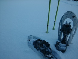
snow, Other
powered by TOURDATA
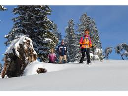
An easy hike at the Kasberg!
Walking time: 1 hour
Difficulty level: easy
Refreshments: cottage "Kasbergalm", cottage "Sepp Huber Hütte"
Viewpoints: Rest area "Blick ins Almtal", rest area "Seeblick"
Route: The trail "Höhenloipe" starts at the mountain station of the group 12 orbit (B). Even before the pump house you branch off into the forest. The forest path leads to the reservoir pond and further to the "Hausboden". Once there, you turn around and walk along the track towards the "Fun Jet" back to the starting point.
Good to know: This route is also available for experienced cross-country skiers and skaters.
Parking
- Parking space: 200
- Bus parking space: 4
- Charging point for electric cars (free of charge)
- Suitable for groups
- Suitable for seniors
- Suitable for single travelers
- Suitable for children
- Early winter
- Deep winter
Please get in touch for more information.

Schindlbach 9
4645 Grünau im Almtal
Phone +43 7616 7085
E-Mail info@kasberg.at
Web www.kasberg.at/
Web skisport.com/Kasberg/de/Winter-am-K…
http://www.kasberg.at/
https://skisport.com/Kasberg/de/Winter-am-Kasberg/Schneeschuhwandern
https://skisport.com/Kasberg/de/Winter-am-Kasberg/Schneeschuhwandern
Interactive elevation profile
Create PDF
Tour-Details
Path number: 3
Starting place: 4645 Grünau im Almtal
Destination: 4645 Grünau im Almtal
duration: 0h 30m
length: 1,5 km
Altitude difference (uphill): 64m
Altitude difference (downhill): 63m
Lowest point: 1.469m
Highest point: 1.516m
difficulty: easy
condition: easy
panoramic view: Some Views
Paths covering:
snow, Other
powered by TOURDATA


