Klachau - Trautenfels


- culturally interesting
Interactive elevation profile
Create PDF
Tour-Details
Starting place: 8993 Grundlsee
Destination: 8950 Stainach
duration: 2h 15m
length: 9,4 km
Altitude difference (uphill): 147m
Altitude difference (downhill): 336m
Lowest point: 645m
Highest point: 840m
difficulty: easy
condition: medium
panoramic view: Some Views
Paths covering:
Asphalt, Path / trail, Street, Hiking trail, Other
powered by TOURDATA
roadblock: Lessern: Sperre Wegabschnitt Naturlehrpfad
since 21.06.2023 Short description:
We leave the region Ausseerland - Salzkammergut towards the next region called "Ennstal".
We leave the region Ausseerland - Salzkammergut towards the next region called "Ennstal".
Quality of experience: ***
Recommended season:
- January
- February
- March
- April
- May
- June
- July
- August
- September
- October
- November
- December
Properties:
- Refreshment stops available
- Cultural/historical value
Via the are called "Girtstatt", "Klachau" towards the village Lessern, Unterburg accompanied by a beautiful view to the village Pürgg and the castle "Schloss Trautenfels".
Tip:
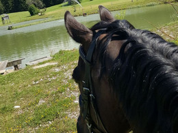
Taking a ride on a horse on approved forest roads and paths is allowed from 08.30 a.m until two hours before dusk. Feeding areas and raised stands shall be avoided to be passed.
In wintertime horse riding is not allowed on roads which are not cleaned from the snow.
Only with a valied badge rides are allowed.
Anual fee: € 100,00
Weekly fee: € 10,00
This is available by the following persons:
Walter Hillbrand, +43 664 64 60 387, Bad Aussee
Karin Ceipek, +43 664 58 03 503, Bad Mitterndorf
Safety guidelines:
Please note the exclusion of liability!
Starting point: Restaurant "Gasthof Moser", Klachau
Destination: "Schloss Trautenfels"
further information:
- Board possible
Details riding
Accessibility / arrival
Getting there
Detailed information how to get to the Ausseerland – Salzkammergut you will find on our website!
Most economical season
- Spring
- Summer
- Autumn
- Early winter
- Deep winter
Please get in touch for more information.
Bad Mitterndorf 58
8983 Bad Mitterndorf
Phone +43 3623 2444
E-Mail info.badmitterndorf@ausseerland.at
Web www.ausseerland.at
http://www.ausseerland.at
Interactive elevation profile
Create PDF
Tour-Details
Starting place: 8993 Grundlsee
Destination: 8950 Stainach
duration: 2h 15m
length: 9,4 km
Altitude difference (uphill): 147m
Altitude difference (downhill): 336m
Lowest point: 645m
Highest point: 840m
difficulty: easy
condition: medium
panoramic view: Some Views
Paths covering:
Asphalt, Path / trail, Street, Hiking trail, Other
powered by TOURDATA


