The Loser


- Flatly
Interactive elevation profile
Create PDF
Tour-Details
Paths covering:
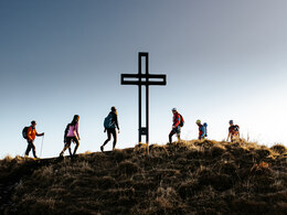
A mountainous hiking route on top of Altaussee's landmark mountain which offers outstanding views to the unique enviorment of the entire region.
Quality of experience: ****
Recommended season:
- June
- July
- August
- September
- October
Properties:
- Loop
- Scenic
- Refreshment stops available
- Geological highlights
- Summit route
This tour can be done in both directions. For people who have no heads for heights it is recommended to take the way upwards from the eastbank of the lake "Augstsee", in this case not clockwise.
Directions:
From the parking above the "Loserhütte" we walk to the hut and cross the also in summertime visible slope in a westward direction. We carry on following the marked path between the last trees and then walk upwards the steep hillside in direction to the Loser. Reaching the saddle there is a parting of the ways. Turning to the left we head to the peak of the mountain.
After a break at the summit cross we take the same way downwards until the mentioned parting of the ways. Now we carry on walking straight ahead along the back of the moutain until we reach an interesting formation of the rocks the so-called"Loserfenster", which has its name due to the look of a window itself. Then the path guides above the top station of the lift on a cliffy area and later on steeply downwards to the lake "Augstsee". From the top station of the lift there is also a possibility to take a path to the lake, which is not that steep. Breathtaking views are offered in this area of outstanding beauty. After enjoying a rest or even a bath in the lake the tour is continued by the walk to the restaurant "Loseralm", underneath the sheer rock walls to the valley station of the chairlift and finally reaching the parking, where we started our tour.
The terrace of the Loserhütte invites us now for a stop, where its visitor can enjoy once again the beautiful and wide view.
Tip:
The way up to the peak of the Loser via the are called "Loser-Törl" is a special tour, which requires entourage by someone
Safety guidelines:
During the whole tour and especially for the way down from the so-called "Hochanger" to the lake "Augstsee" it is recommended to have no fear of heights and a sure foot. An alternative route is available.
Please note the exclusion of liability!
Equipment:
An appropriate equipment for hiking and good hiking boots are necessary!
Additional information:
www.willkommeninaltaussee.at
More information about the region:
TVB Ausseerland – Salzkammergut
Tel. +43 3622 54040-0
info@ausseerland.at
www.ausseerland.at
further information:
- Flatly
- Board possible
Getting there
Detailed information how to get to the Ausseerland – Salzkammergut you will find on our website!
Public Transit
Train station nearby: Bad Aussee
ÖBB (train): www.oebb.at
Verbundlinie Steiermark (bus): www.busbahnbim.at
Transport service Narzissenjet
No transport of bicycles possible!
Parking
Parking above the "Loserhütte" or at the large parking at the "Loseralm" all the way up.
- Summer
- Autumn
Please get in touch for more information.
Fischerndorf 61
8992 Altaussee
Phone +43 3622 71643
E-Mail info.altaussee@ausseerland.at
Web www.ausseerland.at
Interactive elevation profile
Create PDF
Tour-Details
Paths covering:


