Knoppenmoos


Interactive elevation profile
Create PDF
Tour-Details
Starting place: 8984 Bad Mitterndorf
Destination: 8983 Bad Mitterndorf
duration: 2h 30m
length: 12,7 km
Altitude difference (uphill): 210m
Altitude difference (downhill): 190m
Lowest point: 768m
Highest point: 855m
difficulty: very easy
condition: easy
panoramic view: Dreamtour
Paths covering:
Asphalt, Path / trail, Gravel, Hiking trail, Other
powered by TOURDATA
Short description:
The are around the „Knoppenmoos“ and the way throughout the „Laasenweg“ are considered to be unique natural treasures for aficionados.
The are around the „Knoppenmoos“ and the way throughout the „Laasenweg“ are considered to be unique natural treasures for aficionados.
Quality of experience: ****
Recommended season:
- January
- February
- March
- April
- May
- June
- July
- August
- September
- October
- November
- December
Properties:
- Refreshment stops available
- Botanical highlights
Directions:
From the center of Kainisch we have to take the way to the fish farm. There you shall take the turn to the left in direction to “Auboden” and Mühlreith. From then on you follow the bicycle route “R19” until you reach the inn “Jausenstation Stieger”. From then on downwards, passing the railway crossing, and then after about 200 m to the right. Via the area “Heimreith” we carry on into the direction of the main road and next to it eastwards till we turn to the right. Then we follow the path number 19 and follow the next road until we reach a small one in the fields turning to the right. We follow this in direction of Obersdorf and then carry on the “Laasenweg” till we reach Bad Mitterndorf.
Tip:
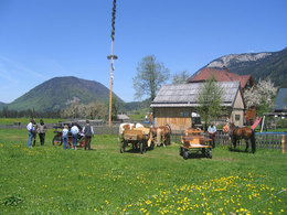
Taking a ride on a horse on approved forest roads and paths is allowed from 08.30 a.m until two hours before dusk. Feeding areas and raised stands shall be avoided to be passed.
In wintertime horse riding is not allowed on roads which are not cleaned from the snow.
Only with a valied badge rides are allowed.
Anual fee: € 100,00
Weekly fee: € 10,00
This is available by the following persons:
Walter Hillbrand, +43 664 64 60 387, Bad Aussee
Karin Ceipek, +43 664 58 03 503, Bad Mitterndorf
Safety guidelines:
Please note the exclusion of liability!
Starting point: Center of Kainisch
Destination: Center of Bad Mitterndorf
further information:
- Board possible
Details riding
Accessibility / arrival
Getting there
Detailed information how to get to the Ausseerland – Salzkammergut you will find on our website!
Most economical season
- Spring
- Summer
- Autumn
- Early winter
- Deep winter
Please get in touch for more information.
Bad Mitterndorf 58
8983 Bad Mitterndorf
Phone +43 3623 2444
Fax machine +43 3623 2444 - 4
E-Mail info.badmitterndorf@ausseerland.at
Web www.ausseerland.at
http://www.ausseerland.at
Interactive elevation profile
Create PDF
Tour-Details
Starting place: 8984 Bad Mitterndorf
Destination: 8983 Bad Mitterndorf
duration: 2h 30m
length: 12,7 km
Altitude difference (uphill): 210m
Altitude difference (downhill): 190m
Lowest point: 768m
Highest point: 855m
difficulty: very easy
condition: easy
panoramic view: Dreamtour
Paths covering:
Asphalt, Path / trail, Gravel, Hiking trail, Other
powered by TOURDATA


