horse riding way - middle Lidaun round


- All weather
Interactive elevation profile
Create PDF
Tour-Details
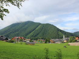
Starting place: 5324 Faistenau
Destination: 5324 Faistenau
duration: 3h 2m
length: 10,2 km
Altitude difference (uphill): 274m
Altitude difference (downhill): 268m
Lowest point: 662m
Highest point: 841m
difficulty: medium
condition: medium
panoramic view: Individual Views
Paths covering:
Asphalt, Path / trail, Street, Hiking trail
powered by TOURDATA
In Faistenau there are 7 riding trails which can be combined. The trails are in total about 40km long and leading over paths, grazings, forest- and public streets with beautiful views over the surrounding.
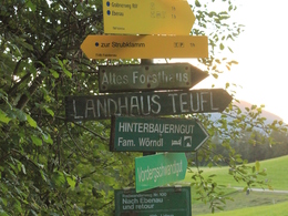
Start village square. Walk behind the tourism office, pass the farmer and take the path down to the bridge. After the bridge you take the way on your left hand side and walk up the small hill. On the road you turn left again and ride on your horse on the Lidaunstraße till you reach Schwarzau. After that turn left at the next junction. Ride straight ahead till you reach the Felsenbad and the path to the Kugelberg. Take the way up to Kugelberg and walk back to Bramsau Bräu restaurant and the village centre.
Start village square. Walk behind the tourism office, pass the farmer and take the path down to the bridge. After the bridge you take the way on your left hand side and walk up the small hill. On the road you turn left again and ride on your horse on the Lidaunstraße till you reach Schwarzau. After that turn left at the next junction. Ride straight ahead till you reach the Felsenbad and the path to the Kugelberg. Take the way up to Kugelberg and walk back to Bramsau Bräu restaurant and the village centre.
Details riding
- Area: medium
- Good riding experience: medium
- Feeding possible for horses
- Housing possibility for horses
- Accommodations for riders
- horse trough
Parking
- Parking space: 150
- All weather
- Spring
- Summer
- Autumn
- Early winter
- Deep winter
Please get in touch for more information.
Am Lindenplatz 1
5324 Faistenau
Phone +43 6226 8384 - 41
E-Mail faistenau@fuschlseeregion.com
Web fuschlsee.salzkammergut.at/willkomm…
http://fuschlsee.salzkammergut.at/willkommen-am-fuschlsee/faistenau.html
Interactive elevation profile
Create PDF
Tour-Details
Starting place: 5324 Faistenau
Destination: 5324 Faistenau
duration: 3h 2m
length: 10,2 km
Altitude difference (uphill): 274m
Altitude difference (downhill): 268m
Lowest point: 662m
Highest point: 841m
difficulty: medium
condition: medium
panoramic view: Individual Views
Paths covering:
Asphalt, Path / trail, Street, Hiking trail
powered by TOURDATA


