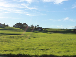
horse riding way - vordersee round


- All weather
- Suitable for families
- Flatly
Interactive elevation profile
Create PDF
Tour-Details
Starting place: 5324 Faistenau
Destination: 5324 Faistenau
duration: 0h 24m
length: 4,6 km
Altitude difference (uphill): 100m
Altitude difference (downhill): 100m
Lowest point: 500m
Highest point: 600m
difficulty: very easy
condition: very easy
panoramic view: Some Views
Paths covering:
Path / trail, Gravel, Street
powered by TOURDATA
Old fire brigade – Hamoosau – Vordersee – old fire brigade
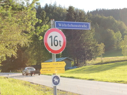
At the fire brigade straight ahead to “Tiefbrunnau”. Take the third street on your right hand side & go down to Hamoosau. Cross the Brunnbach go trough Hamoosau till you reach “Rafflweg” in Vordersee, on the main street turn right and take the first street on your right hand side “ Brunnmühlweg” and back over the Wöhrlehenstraße to the old fire brigade.
Connection to Kugelberg is possible over “Rosenlehenstraße” (approx. 500 meters)
further information:
- Flatly
Details riding
- Area: easy
- Good riding experience: easy
- Feeding possible for horses
- Housing possibility for horses
- Accommodations for riders
Parking
- Parking space: 50
- All weather
- Suitable for groups
- Suitable for friends
- Spring
- Summer
- Autumn
- Early winter
- Deep winter
Please get in touch for more information.
Am Lindenplatz 1
5324 Faistenau
Phone +43 6226 8384 - 41
E-Mail faistenau@fuschlseeregion.at
Web fuschlsee.salzkammergut.at/willkomm…
https://fuschlsee.salzkammergut.at/willkommen-am-fuschlsee/faistenau.html
Interactive elevation profile
Create PDF
Tour-Details
Starting place: 5324 Faistenau
Destination: 5324 Faistenau
duration: 0h 24m
length: 4,6 km
Altitude difference (uphill): 100m
Altitude difference (downhill): 100m
Lowest point: 500m
Highest point: 600m
difficulty: very easy
condition: very easy
panoramic view: Some Views
Paths covering:
Path / trail, Gravel, Street
powered by TOURDATA


