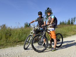
Fischerbühel roundway


- pets allowed
- Suitable for families
- Suitable for pushchairs
- Flatly
Interactive elevation profile
Create PDF
Tour-Details
Path number: 2
Starting place: 4644 Scharnstein
Destination: 4644 Scharnstein
duration: 1h 25m
length: 5,5 km
Altitude difference (uphill): 48m
Altitude difference (downhill): 46m
Lowest point: 520m
Highest point: 561m
difficulty: easy
condition: easy
panoramic view: Individual Views
Paths covering:
Asphalt, Gravel
powered by TOURDATA
Tennisplatz Mühldorf – Wieseck – Fischerbühel –
Matzing – Bühelbauer – Flugplatz – In der Haid – Mühldorf
Matzing – Bühelbauer – Flugplatz – In der Haid – Mühldorf
Mühldorf
Tennisplatz Mühldorf
- Suitable for groups
- Suitable for pushchairs
- Pets allowed
- Suitable for single travelers
- Suitable for friends
- Suitable for couples
- Suitable for children
- Spring
- Summer
- Autumn
- Early winter
Please get in touch for more information.
Im Dorf 17
4645 Grünau im Almtal
Phone +43 7616 8268
Fax machine +43 7616 8895
E-Mail almtal@traunsee-almtal.at
Web traunsee-almtal.salzkammergut.at/
Web www.scharnstein.ooe.gv.at/
https://traunsee-almtal.salzkammergut.at/
https://www.scharnstein.ooe.gv.at/
https://www.scharnstein.ooe.gv.at/
Interactive elevation profile
Create PDF
Tour-Details
Path number: 2
Starting place: 4644 Scharnstein
Destination: 4644 Scharnstein
duration: 1h 25m
length: 5,5 km
Altitude difference (uphill): 48m
Altitude difference (downhill): 46m
Lowest point: 520m
Highest point: 561m
difficulty: easy
condition: easy
panoramic view: Individual Views
Paths covering:
Asphalt, Gravel
powered by TOURDATA


