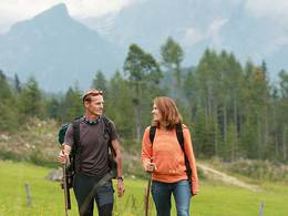
Wanderweg 2 - Gschwandt


- culinary interesting
- Possible accommodation
Interactive elevation profile
Create PDF
Tour-Details
Starting place: 4816 Gschwandt
Destination: 4816 Gschwandt
duration: 0h 41m
length: 2,6 km
Altitude difference (uphill): 24m
Altitude difference (downhill): 42m
Lowest point: 483m
Highest point: 519m
difficulty: medium
condition: medium
panoramic view: Great panorama
Paths covering:
Asphalt, Hiking trail
powered by TOURDATA
Gschwandt town centre (Gh Grafinger/Gh Gattinger) - Hubertuskappelle - Steinbichl-Brunnental - Hochholz-Wald - Steigerstr. - briefly along the B 120 to Müllerbachstr. (Landgasthof Baumgarten 200m on the left) - along the Wasserlosen Bach to the Frauenweide estate - left towards Flachberg and hiking trail 1
Most economical season
- Spring
- Summer
- Autumn
Please get in touch for more information.
4810 Gmunden
Phone +43 7612 74451
E-Mail info@traunsee-almtal.at
Web www.traunsee-almtal.at/gschwandt
http://www.traunsee-almtal.at/gschwandt
Interactive elevation profile
Create PDF
Tour-Details
Starting place: 4816 Gschwandt
Destination: 4816 Gschwandt
duration: 0h 41m
length: 2,6 km
Altitude difference (uphill): 24m
Altitude difference (downhill): 42m
Lowest point: 483m
Highest point: 519m
difficulty: medium
condition: medium
panoramic view: Great panorama
Paths covering:
Asphalt, Hiking trail
powered by TOURDATA


