Hongar Nr. 6


Interactive elevation profile
Create PDF
Tour-Details
Starting place: 4812 Pinsdorf
Destination: 4812 Pinsdorf
duration: 2h 7m
length: 5,6 km
Altitude difference (uphill): 430m
Altitude difference (downhill): 25m
Lowest point: 463m
Highest point: 895m
difficulty: easy
condition: easy
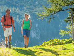
panoramic view: Great panorama
Paths covering:
Asphalt, Hiking trail
powered by TOURDATA
Pinsdorf town square - Innergrub - Kufhaus - Hongar
Most economical season
- Spring
- Summer
- Autumn
Please get in touch for more information.
4812 Pinsdorf
Phone +43 7612 63955
Fax machine +43 7612 63955 - 20
E-Mail gemeinde@pinsdorf.ooe.gv.at
Web www.pinsdorf.at
http://www.pinsdorf.at
Interactive elevation profile
Create PDF
Tour-Details
Starting place: 4812 Pinsdorf
Destination: 4812 Pinsdorf
duration: 2h 7m
length: 5,6 km
Altitude difference (uphill): 430m
Altitude difference (downhill): 25m
Lowest point: 463m
Highest point: 895m
difficulty: easy
condition: easy
panoramic view: Great panorama
Paths covering:
Asphalt, Hiking trail
powered by TOURDATA


