Faistenau - Tiefbrunnau Trail
5324 Faistenau

Tiefbrunnau Trail – 20 kilometres classic + 15 kilometres skating
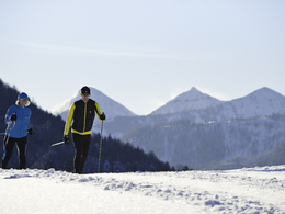
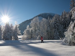
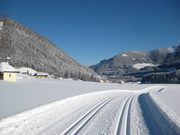
The whole 55-kilometre network of cross-country skiing trails in Faistenau comprises perfectly groomed cross-country skiing runs with difficulty levels ranging from easy to intermediate. Your cross-country skiing expedition starts at the sports ground (cross country skiing stadium) in the village. The trail will take you along the edge of the village to the beautiful Tiefbrunnauer Valley. The cross-country skiing runs are located in sunny areas and do not boast major differences in altitude.
Paths covering:
further information:
- Flatly
- Board possible
Details - Trail
- Nordic skiing facilities: Marked Nordic skiing run
- Type of Nordic skiing run: Classic style
- locker
daily accessible
By car:
Arrival via the West motorway A1, junction Thalgau.
Follow the main road (B 158) in direction to Hof bei Salzburg until you reach the traffic circle “Baderluck”. At the first junction turn into the main road (Hinterseestraße) and after a few kilometers you reach your holiday destination Faistenau.
There are plenty of parking areas near the starting points.
With the Postbus
From Salzburgs bus station, opposite the train station, there is a good bus connection into the
Fuschlsee region and also to Faistenau. You will find details in internet under www.svv-info.at.
With the Train
Information and connections can be found under following addresses www.oebb.at or www.bahn.de
By Air
Salzburg Airport lies very close to Salzburg city. The Bus Nr. 2 brings you from the airport to the main station where you change to continue with the post bus.
no parking fees
Access to the cross-country skiing runs is SUBJECT TO A FEE.
The rates for the winter season 2025/26 are:
€ 10 per day,
€ 95 for a season ticket.
Access to the trails is free of charge for young guests under the age of 15. Included in the fee: parking facilities, changing rooms, showers and toilets.
- Suitable for groups
- Suitable for schools
- Deep winter
Please get in touch for more information.
Am Lindenplatz 1
5324 Faistenau
Phone +43 6226 8384 - 41
E-Mail faistenau@fuschlseeregion.com
Web www.langlaufdorf.at
Web www.faistenau.at
http://www.faistenau.at
You can also visit us on
Facebook


