On the tracks of the professional cyclists


- culturally interesting
- Possible accommodation
Interactive elevation profile
Create PDF
Tour-Details
Starting place: 5310 Mondsee am Mondsee
Destination: 4400 Steyr
duration: 7h 0m
length: 205,0 km
Altitude difference (uphill): 2.481m
Altitude difference (downhill): 2.663m
Lowest point: 278m
Highest point: 843m
difficulty: difficult
condition: very difficult
panoramic view: Great panorama
Paths covering:
Asphalt
powered by TOURDATA
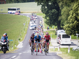
A challenge for hobby athletes: the 199km long Upper Austria stage of the Austria Cycle Tour (2016) from Mondsee to Steyr!
The route in Upper Austria, which is exactly 198.5km long, starts from Mondsee and goes along the Wolfgangsee lake via Bad Ischl to the Attersee lake and on to Altmünster at the Traunsee lake. It continues through the Alpine foothills to Stadl-Paura towards northern Austria to Bad Hall and the stage finish at Steyr.
The route in Upper Austria, which is exactly 198.5km long, starts from Mondsee and goes along the Wolfgangsee lake via Bad Ischl to the Attersee lake and on to Altmünster at the Traunsee lake. It continues through the Alpine foothills to Stadl-Paura towards northern Austria to Bad Hall and the stage finish at Steyr.
- Suitable for single travelers
- Suitable for couples
- Spring
- Summer
- Autumn
Please get in touch for more information.
Stadtplatz 27
4400 Steyr
Phone +43 7252 53229 - 0
E-Mail info@steyr-nationalpark.at
Web www.steyr-nationalpark.at
http://www.steyr-nationalpark.at
You can also visit us on
Visit us on Facebook Visit our videochannel on YouTube Wikipedia")
")
")
")
")
Nationalpark Kalkalpen_Sonja Sch%c3%a4fer (© Nationalpark Kalkalpen/Sonja Schäfer)")
")
")
")
")
")
")
")
Interactive elevation profile
Create PDF
Tour-Details
Starting place: 5310 Mondsee am Mondsee
Destination: 4400 Steyr
duration: 7h 0m
length: 205,0 km
Altitude difference (uphill): 2.481m
Altitude difference (downhill): 2.663m
Lowest point: 278m
Highest point: 843m
difficulty: difficult
condition: very difficult
panoramic view: Great panorama
Paths covering:
Asphalt
powered by TOURDATA


