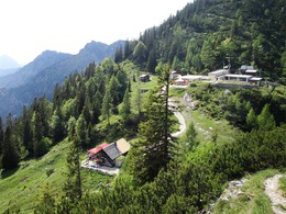
Scenic Walk to Katrinalm


- Flatly
Interactive elevation profile
Create PDF
Tour-Details
Starting place: 4820 Bad Ischl
Destination: 4820 Bad Ischl
duration: 5h 32m
length: 9,2 km
Altitude difference (uphill): 969m
Altitude difference (downhill): 969m
Lowest point: 479m
Highest point: 1.422m
difficulty: medium
condition: medium
panoramic view: Dreamtour
Paths covering:
Hiking trail
powered by TOURDATA
Hike to the cable car station at the summit of the Katrin
Walking time: 2 hours 30 minutes ascent - descent 2 hoursDifference in altitude: 940 m ascent, descent 940 m
Requirements: The trail frequently crosses the ski run. Pay attention to the red-white-red markings!
Variants: Another ascent route leads from the town to Lauffen and the Katrinalm.
This starting point can be reached from Bad Ischl by bus or train.
Ascend from the valley cable car station a few metres up the ski run, leave this just above a tall building on the left and make in a wide curve back to the building exit. After
50 metres turn right and follow a forest track. Near to a waterworks building there is a
sign "Katrinalm/mountain station 2 h" (47 ° 41'56 "N - 013 ° 36'00 " E - 582 m). At this point leave the forest track to the left and climb through the woods for about 30 minutes. This is steep
to the ski run and a signpost (47 ° 41'47 "N - 013 ° 35'46 " E - 800
m). Follow this for a few minutes to a forest track. Signpost (47 ° 41'49 "N - 013 ° 35'25 " E -895 m). This divides the ascent route. Go straight ahead and after a few metres leave the ski run to the right by a bank in the forest, the path will soon return again to the ski slope. When meeting a forest track leave the ski slope to the left. This track will cross the ski slope twice move as it covers the last 300 metres climb to the top cable car station (47 ° 41'09 "N - 13 ° 34'58 " E - 1415 m )
Descend through Windengraben, crossing by the Katrinalmhütte (refreshment possible) for 15 minutes to the southern slopes of Adamkogel and to the ski slope (Sign 47 ° 41'05 "N - 013 ° 35'33" E- 1362 m). The descent path broadly follows the ski slope, often crossing forest tracks.
From an altitude of 1000 m it follows the forest road straight to an intersection (signpost 47 ° 41'41 "N - 013 ° 35'38 " E -960 m). Keep right and in a few minutes reach the uphill path at an altitude of 895 m, follow this downhill to return to the starting point.
Starting point: Car Park at Katrinseibahn (cable car) (47 ° 41'54 "N -013 ° 36'27 " O) reached on Route 11 from the centre. Directions: From the centre of Bad Ischl follow the signs to "Katrinseilbahn". The starting point can also be reached by City Line bus
Destination: As starting point - round trip
further information:
- Flatly
Most economical season
- Summer
Please get in touch for more information.
4820 Bad Ischl
Phone +43 6132 27757
Fax machine +43 6132 27757 - 77
E-Mail office@badischl.at
Web www.badischl.at
http://www.badischl.at
Interactive elevation profile
Create PDF
Tour-Details
Starting place: 4820 Bad Ischl
Destination: 4820 Bad Ischl
duration: 5h 32m
length: 9,2 km
Altitude difference (uphill): 969m
Altitude difference (downhill): 969m
Lowest point: 479m
Highest point: 1.422m
difficulty: medium
condition: medium
panoramic view: Dreamtour
Paths covering:
Hiking trail
powered by TOURDATA


